
The Story of Romney Marsh
Much of this article was provided by Jill Eddison, then with the Romney Marsh Research Trust.
The Story of Romney Marsh
Romney Marsh is one of the three great marshlands of England. Nearly all this 100 square miles of flat land lies below the level of high tides. It is flanked on south and east by the sea. How was it formed? How is it drained? And how has it is it used today?
Formation of the Marsh
Origins
The Marsh was formed in the 10,000 years since the last Ice Age. After the ice melted, sea leve1 rose quickly up to 6,000 years ago. The whole area of Romney Marsh was a wide sandy bay and, as sea level rose, the sea piled in layer upon layer of sand until it was about 10 metres deep.
Then a great change took place, which altered the area for ever. A massive supply of flint pebbles (known as shingle or, commercially, as gravel) which had been eroded out of the Chalk of Dorset, Hampshire and Sussex during the Ice Age, began to arrive from the south-west, and built out a great bank towards Hythe. Behind this barrier, the sandy bay became salt marsh, with fresh-water swamp in the valleys.
Since then the outer coastline, consisting of massive barriers of shingle, has been continually changing, and so have the tidal inlets which once provided harbours near Hythe, Romney and Rye.
How this Happened
You can see the sea and the wind at work today, building up and altering the coastline, just as happened in the past:
- Shingle is moved along by the waves. Go down to any shingle beach and watch what happens when a wave breaks on the shingle. Pebbles will be thrown up the beach, probably at an angle. In a storm, when the waves are high, and you will see great quantities of the beach being moved along.
- Salt marshes are built up by the inter-action of plant-growth and deposition of sediments. The English Channel looks dirty. This is because it carries great quantities of fine- grained sediment suspended in the water. The tide flows in round the end of the shingle banks, or up river estuaries, into calm water behind. At high tide the movement of the water ceases, and the load of sediment is deposited. When this has built up sufficiently, plants specially adapted to grow in salt water flourish. Their leaves trap more sediment, and thus help to built the surface up above the level of all but the highest tides. At this stage, the twice-daily flow of the tides is limited to channels winding around clumps of plants.
- Sand Dunes. The oldest dunes at Camber are only 200 years old, and parts are still growing out to sea. As the tide goes down the wide sandy beach dries out. If the wind is blowing onshore, it picks up some of that sand, and blows it inland to form the dunes. As a result the coastline near the coastguard cottages east of Rye Golf Club has grown outwards by 100 m. in the last 20 years. This can be seen happening especially in winter gales.
The Roman Marsh
Scattered archaeologica1 evidence indicates that the Marsh was still a salt-marsh in Roman times. Burnt clay (briquetage) and broken pots provides evidence of a widespread salt-extraction. Professor Barry Cunliffe has suggested that men would have lived on the Marsh in summer, using the excellent pasture for sheep and cattle, and evaporating salt (a very valuable commodity) from sea water at the marsh edge. In winter these people probably retreated to the surrounding upland. There is no known evidence that the Romans built defences to keep out the incoming tides.
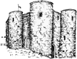
In about A.D. 350, a marsh inlet was guarded by massive shore fort on the hillside below Lympne. This was a base for the Roman fleet, the Classis Britannica, which was attempting to ward off Saxon invaders. Thus, except for the shingle barriers, most of the marsh was under water until at least Saxon times. It was a changing kaleidoscope of land and water, changing from high to low tide, from season to season and from century to century.
Marsh Drainage
Reclamation and Occupation
The whole Marsh is sub-divided into several different smaller marshes, each of which was reclaimed at a different time. The map shows the division into Romney Marsh proper, Walland Marsh, Denge Marsh, Pett Level, and the Rother Levels.
Denge Marsh
Saxon land-charters show that Denge Marsh, which was surrounded on three sides by massive shingle banks, was occupied in Saxon times.
Romney Marsh Proper
The Domesday Book shows that by 1086 the whole of Romney Marsh Proper was occupied. Domesday recorded most of the churches now known there (and a few which cannot be identified now). At this time, that area was still protected from the sea on the east by a great shingle bank. So it is unlikely that any major sea-walls were needed. To the south lay salt-marsh which probably provided fish and sea-birds to augment the local diet, and reeds and rushes for houses.
Walland Marsh
None of the churches on Walland Marsh are mentioned in Domesday Book, and it was only to cope with the demand for new land caused by a sharply rising population that the frontier of colonisation moved south-west across Walland Marsh.
In the 13th century the sea broke down the shingle barrier which had previously extended across the present area of Rye Bay, from Fairlight to Dungeness. This defended the south side of the Marsh against the sea. The old town and port of Winchelsea (which stood on the shingle barrier somewhere off the present mouth of the Rother) was washed away between 1249 and 1280, and in 1280 king Edward I, ordered three senior officials to establish a new town on ”the hill of Iham”. This is the town of Winchelsea we know today.
Sea-floods in the 1200s and 1300s checked southward colonisation, and the Black Death in 1349 brought demand for new land to an end. Then, between 1400 and 1700 salt-marshes were reclaimed for sheep pasture in connection with the Wealden woollen industry, so that by 1700 the map of Walland Marsh was similar to that of today.
How was it done and what is the result?
Sea Walls and Drainage
As soon as people occupied any part of the Marsh on a year-round basis, they needed to construct an earth bank to keep spring tides and storms out. They also needed to drain rain water away through a sluice, and to keep the drainage channels and ditches clear.
Over the centuries, more and more land was ”inned” in this way. At the same time, the sea gradually moved the protective shingle banks away, and it became necessary to construct sea walls. Half the coastline is now protected by these walls.
– The Dymchurch Wall was built before 1500
– The Broomhill/Camber Wall was built in 1600s
– The Pett Wall was built in the 1950s
The marsh is criss-crossed by an essential network of drainage channels and ditches. Every main drain (known as a ‘sewer’) has an outlet through a sluice to the sea at both ends. This means that if one outlet becomes blocked, or the sluice needs to be repaired, then water can still drain away through the other end.
Farming on the Marsh through the Ages
- Land-use in the Saxon period must have been use of salt-marsh as pasture, which would have continued after parts of the Marsh had been ”inned”.
- Around 1200, the demands of a dense and rising population meant that much of the Marsh was used as arable.
- After the Black Death and later epidemics of the Plague, the Marsh reverted to pasture once again. This continued until the Second World War.
- In World War II food was in short supply, and some of the Marsh was ploughed up. This showed how fertile the Marsh was.
- As a result, from 1960 the Marsh was increasingly ploughed, so that now only about 10% remains as pasture.
Much of this article was provided by Jill Eddison, then with the Romney Marsh Research Trust. Photo © Copyright Stephen Nunney and licensed for reuse under the Creative Commons Licence.